Mora, mint, gooseberries, and babaco

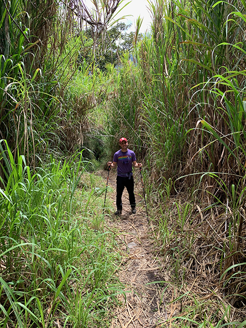
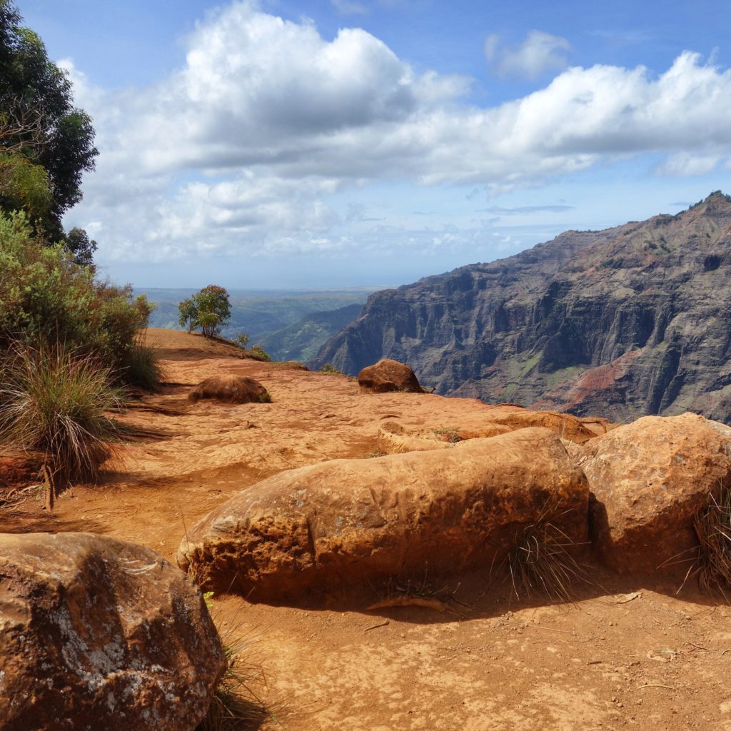
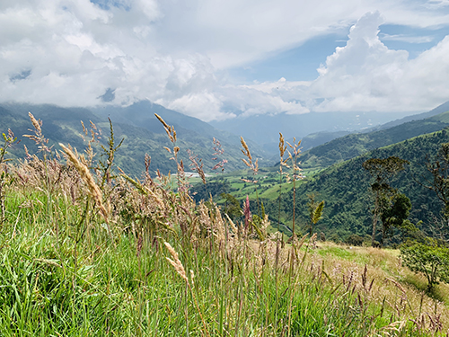
We are generally strong hikers, or so we like to think, but on this trek we held a consistent spot in the back of the pack. The destination was the journey, and we were in no rush to leave the trail behind us. We were on a two-day hike through the Llanganates National Park, dressed in wellies with the imminent threat of rain that never came.

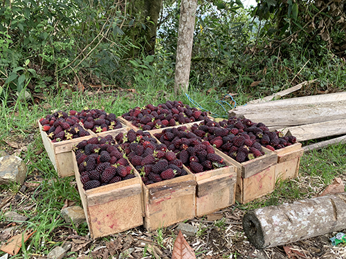
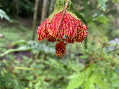
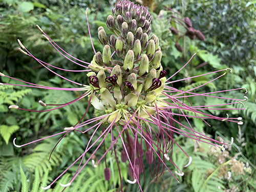
One guide led the way, the other tailed. Andrew, in his persistent habit to make fast friends everywhere he goes, began conversing with Juan Carlo. Juan Carlo steadied every flower I spotted for Andrew to photograph on his iPhone. He pulled fruits and plants from the ground to share with us – mint, gooseberries, babaco. We laughed as we compared the $.10 price of an avocado in Ecuador to the $2.00 price of an avocado in California. You could almost see the pain on Juan Carlo’s face when we told him an avocado may be closer to $4.00 on the East Coast, so we didn’t even broach the subject of avocado toast. Our favorites were the mora berries. They grew in abundance, naturally and farmed, and were shipped across Ecuador to make jugo naturales and vino.

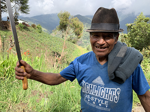
Juan Carlo saw his family friend on the path, an older gentleman who owned a farm large enough to house fruit and livestock. Arnaldo was carrying a machete, and excitedly abided by Andrew’s request to look strong for a photo.

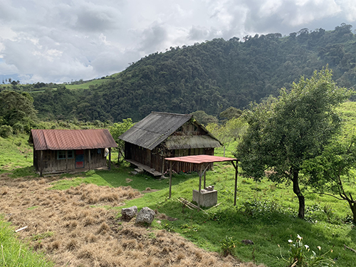
Before sunset we arrived at our camp, a covered flat in the middle of the park where our guides had squeezed together ten tents. The land was owned by a family who farmed trout, so as promised, we fished for our dinner in a pond containing hundreds of trucha. The family got to work, skinning and deboning to create an Ecuadorian feast for the group of us. We ended the night by dipping marshmallows in moonshine to watch them be engulfed by flames over the hot blaze of our campfire, with the rain that had held off pouring onto the tin roofs.

And the next day, we began again.

Activity-filled Alesund

After our bike trip, we take an early ferry back to Bergen, rent a car, and hit the road towards Alesund.  The journey is far, but the weather is perfect, and the fjords are shining.  We stop early and often for food, photographs and viewpoints. An amazing part of Norway’s highway infrastructure is its tunnels.  We go in tunnels that are 5 to 6 kilometers long, and apparently there is one that is more than 20.  Instead of going around every mountain, we go straight through some of them – I love the efficiency and the breathtaking landscape just waits for us on the other side of the tunnel. (We also learn that Norway is working on a tunnel for boats big enough to fit cruise ships.)

The next day, we explore Alesund.  Alesund’s history is bittersweet.  Because of a fire in 1904 that burned down the entire city, everything was rebuilt in the art nouveau style.  And today, the city just seems to fit together. After our typical breakfast of fresh bread, smoked salmon, yogurt and granola, we climb to the top of Sukkertoppen, overlooking the city.  This is actually the second time we get this type of vantage point as we climbed the 418 steps just next to the city for sunset (~11:15pm) last night.

For our next vantage point, we walk through the old city enjoying shops, food stands, and its many boats.  Later, to give our legs a little break, we rent kayaks and circle the city by paddle.  Turns out that when we get a little outside of the protected waters in the center, there are some decent waves that give us a salty splash now and again.

Finally, to round out the day, we drive out to Runde, an island known for its Puffins.  The bridges along the drive are stunning and slightly scary.  They are very steep, one-lane bridges.  As a result, we can’t always tell if another car is coming up the other direction, and if it were, we would have to negotiate how to best pass each other.

Runde ends up being a highlight of the whole trip.  The sky is big with layers of clouds but enough sun to give us lots of energy.  The landscape is as vast as we’ve seen it, and in every direction.  The lighting is warm, the trail we take keeps providing us with new surprising views, and the puffins (although from a distance) are as cute and playful as the stuffed animals of their likeness made us believe.  Runde was a bit of a drive outside of Alesund, but completely worth it.

Waimea Wow

Waimea Canyon was a bit of an afterthought. We’d heard it can get cloudy and wanted to use the morning before the wedding to see if the fog would cooperate. The other couples we’re staying with weren’t as interested in an early morning, so Andrew and I were left by ourselves and out the door by 7:00am.

Waimea1

As luck would have it, we stumble upon a chalkboard sign outside of an old warehouse en-route for coffee. Dark Roost is a small trailer humorously situated inside a oversized warehouse. We order lattes and listen to the Hawaiian roaster cooly tell us the story of how they came to be. Inspired, we buy a mug. Obviously.

The Canyon itself is very beautiful. We give each lookout the appropriate amount of oohs-and-ahhs before proceeding to the next. A Hawaiian guide shares some history. (Add facts about the wettest place on earth, Grand Canyon etc.)

Waimea2

Satisfied, Andrew and I lace up our sneakers and grab our backpack of Cliff bars and water to start our canyon hike. We’d found a quick out-and-back the night before, figuring we’d have only a few hours before the wedding. The eucalyptus dense woods smell of Tiger Balm and the single-track trail reminds me of training in Vermont. Unlike our hike along the Napali Coast, the ground is dry and the elevation gain minimal. We respond energetically with a pace that feels like we’re skipping through the woods.

An hour in, the trees clear, leaving us with the most breathtaking view of Waimea. We at once want to slowly appreciate the beauty surrounding us and excitedly race to see it all, as if beauty like this can’t possibly stay.    

Together, we let the trail lead us the top of the falls marking the end of the hike before turning back to prepare for Drew & Kara’s wedding.

Waimea3

Waimea4

Same Napali Coast by land

Lookout along Napali

We did the same stretch of coastline today, except today we do it by land.  Entertainingly, we get to see the kayaks that were us just a day earlier as we walk along the cliffs of the Napali Coast.   More than yesterday, however, we appreciate that we are in a rainforest.  The weather changes every 10 minutes alternating between hot humid sun, dark windy storm, and everything in between.  The path also takes on a few different looks: thick and squishy clay-like mud, slippery mud between rocks and tree roots, slippery boulders mostly covered in the red clay mud, and deep stream crossings that require some boulder hopping (or crawling in my case).  Needless to say, we realize we’re going to finish this day a bit muddy, a bit wet, and a bit tired, but all worth it because of the sights, sounds, and memories that we’ll get along the way.

Hanakapi’ai beach

Cartwheels on Hanakapi’ai beach

Lindsey and I walk first the 2 miles to Hanakapi’ai beach, where we sit, enjoy, snack, and picture-take.  Then we continue on for another 2 miles to the Hanakapi’ai waterfall.  This is quintessential Hawaii: giant waterfall falling into a huge pond (maybe even a small lake), rainbows come and go, the sun comes and goes, people swimming, laughing, and enjoying nature.  All straight out of a movie.

Hanakapi’ai falls

Through all the challenges of the trail, I believe that I would’ve had a much harder time had I not schlepped my hiking poles from the mainland.  They prevented me from sliding, balanced me across some rather tricky stream crossings, and served as a monopod for my camera when needed.

On the way home we spot at Tahiti Nui, a great local dive in Hanalei for a pair of much needed Mai Tai’s.  Legs still covered in mud, feet still soaking in wet shoes, but a solid sense of accomplishment and excitement for having conquered a small piece of the Hawaiian rainforest.

Hanakapi’ai trail Hanakapi’ai coastline